Riding off highway motorcycles in the backcountry of Iceland.
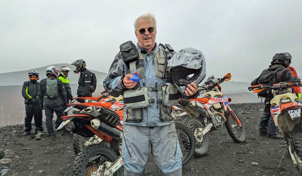
https://www.advrider.com/f/threads/cannonride-iceland-on-dirt-bikes.1857437
Riding off highway motorcycles in the backcountry of Iceland.
https://www.advrider.com/f/threads/cannonride-iceland-on-dirt-bikes.1857437
This is a 1,600 mile adventure motorcycle ride that incorporates a 4WD route, history, and points of interest in northern Minnesota.
MN Border To Border Adventure Tour (MN B2B AT) | Adventure Rider (advrider.com)
 https://photos.smugmug.com/MN-Border-2-Border-Adventure-Tour-MN-B2B-AT/i-ckmkzFp/0/55e3be54/XL/MBT%20004-XL.jpg />
This is a ride I put together that visits locations of a railroad that was constructed in the Upper Peninsula of Michigan but was never used. Beautiful backcountry scenery, some history, and some fun riding.
CannonRide – The Railroad That Never Was

This ride tours locations in the Upper Peninsula of Michigan where the film Anatomy of a Murder was filmed. There are also visits to locations involved in the murder case that the film was based on.
CannonRide – Anatomy of a Murder Tour

“They come to fight a war, some as ground troops, some as paratroopers, and some as combat pilots. The enemy in their war is . . . fire.” Michael Thoele in “Fire Line”

A CannonRide Up the Mid-Atlantic Backcountry Discovery Route (MABDR) (follow this link)
This backcountry motorcycle journey tours scenic and entertaining paved and unpaved mountain roads in the Appalachian region in Virginia, West Virginia, Maryland, and Pennsylvania.
Where to Ride Off-Highway and Dual Sport Motorcycles in Wisconsin
Single Track Motorcycle Trail:
Douglas County http://www.douglascountywi.org/index.aspx?NID=468
Clark County http://www.co.clark.wi.us/index.aspx?NID=227
Jackson County http://www.co.jackson.wi.us/index.as…7AE4CBC1F47%7D
Adams County (Dyracuse Recreation Area) http://www.townofrome.com/recreation…-rec-area-site
Kenosha County (Bong Recreation Area)
http://dnr.wi.gov/topic/parks/name/richardbong/
Other Trail Information:
DNR Off-Road Motorcycle Trails http://dnr.wi.gov/topic/parks/activi…oadtrails.html
VVMapping On-Line Trail Guide http://www.vvmapping.com/trails/trailInfoWI.html
Trip Planner for ATV Trails
http://php.wisinfo.com/wisconsinoutd…d=ATV%20Trails
Travel Wisconsin (search for “motorcycle) http://www.travelwisconsin.com/
WATVA Trail System Info (contains contact info for trail systems) https://www.watva.org/index.php/Trails-by-County.html
Dual Sport and Events:
AMA District 16 Event Guide http://issuu.com/cycleusa/docs/d16eventguide14web
Wisconsin Area Rides and Events (Adventure Rider) http://advrider.com/forums/showthread.php?t=201507
GPX Tracks to Download for Self-Guided Dual Sport Rides http://dco43054.com/phpbb/viewforum.php?f=2
Important Information:
Always check to make sure the trails are open. Sometimes trails are closed for things like wet conditions, hunting, or maintenance. Verify before you go.
There can be some confusion as to what portions of a trail may be open to motorcycles. For example, the Oconto Country trail system does not allow motorcycles. However, the portions of the system that are in the National Forest do permit motorcycle use as USFS rules apply. Signage may not be clear in a case like this.
Some trails are open to dual sport motorcycles but not unlicensed OHM.
Some trails are open to motorcycles generally, but have short signed segments closed to motorcycles that interrupt using the entire trail. Marinette County is an example of where this is in place.
Generally, motorized trails in the National Forests are open to dual sport motorcycle use. Unlicensed OHM may be restricted where the trail joins a road where they may be prohibited.
USFS Motor Vehicle Use Maps (MVUM) describe what forest paths are open to motorized travel during what dates. These can be found on the web page for the particular forest you are interested in.
Some counties open their forest roads to motorized travel. This will allow licensed dual sport motorcycles but may not allow unlicensed OHM.
Some ATV trails may allow licensed dual sport motorcycle use on their trails but not allow unlicensed OHMs.
Sometimes the rules change at the county line. When riding trails, make sure you know where you are and that you don’t stray onto trails that are not open to motorcycles.
Some counties require that you purchase a county permit to use their trails (Clark and Jackson as an example).
The point of all of this is that you must carefully check to be sure you are allowed on a particular trail with your conveyance and that the trail is otherwise open.
It is very difficult to keep the sources listed above current, so don’t accept that everything that is included there as being absolutely correct or current. A quick check of the web site or a phone call to the trail managers can verify what you need to know.
Eventually we will have a sticker program for motorcycles and trail use. This will lead to a more clearly defined catalog of riding opportunities.
This page contains links to GPS files that I am sharing with others. The files, in GPX format, are available for download.
HELPFUL GPS INFORMATION AND TUTORIALS
Scouting, Mapping, and Sharing GPS Guided Rides
Video – following tracks/routes
ADVENTURE STYLE GPS FILES
Black Hills
Comprehensive collection of paths and points of interest for riding the Black Hills.
Great Divide Ride
Back country ride from Banff, AB to Antelope Wells, NM with comprehensive collection of points of interest.
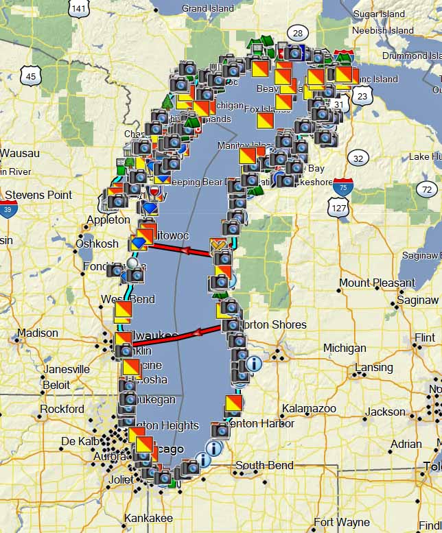
Lake Michigan
Paths and points of interest for circling Lake Michigan.
Lake Superior
Route and points of interest for a comprehensive circle tour of Lake Superior.
Loneliest Road (NV-CA-AZ-UT) A trip across Hwy 50, Hwy 395, and more.
Mid-Atlantic Backcountry Discovery Route (MABDR)
Moab Sampler
A collection of tracks to ride on some of the trails near Moab.
Northern Wisconsin Adventure Trail (NWAT)
Pony Express
Paths and points of interest for the Pony Express Route from Missouri through Wyoming.
TWUPAT (Trans WI & UP Adventure Trail St Ignace to Duluth)
Upper Mississippi River
Paths and points of interest for a ride up and down the Upper Mississippi river along the west coast of Wisconsin.
Upper Peninsula Adventure Trail
Adventure dual sport ride with options for small/medium and large dual sports.
Wisconsin-Michigan Adventure Trail
A 1,100 mile dual sport loop that takes in Michigan and Wisconsin.
Wisconsin-Michigan Dual Sport Adventure
A 2,200 mile dual sport ride that takes in Michigan and Wisconsin including the Trans-Wisconsin Trail.
WISCONSIN BASED GPS FILES
This is a series of dual sport rides based out of Boulder Junction (WI) which promotes itself as a dual sport destination. It is also a regular location of the Central Adventure Motorcycle Rally which involves dual sport and adventure motorcyclists. On a previous site, this download section has been visited 115,756 times.
Duluth, Clam Lk, Ashland, Bayfield
Eagle River
Paths and points of interest for some dual sport rides based out of Eagle River, WI, including the NHAL State Forest.
Northern Highland American Legion (NHAL)
Gangster Tour
Paths and points of interest from the gangster days in Wisconsin.
Kettle Moraine Scenic Drive
Wisconsin’s scenic drive through the Kettle Moraine.
Rustic Roads
A collection of tracks that allow riders from different regions to ride Wisconsin’s Rustic Roads and qualify for a motorcycle patch.
South Central WI Hills, Valley, and Trail
DS/ADV Paths Based Out of the Tamaracks OHM Trail in Vilas County
Vilas County Tamaracks
Paths and points of interest for some DS and ADV rides based out of the Tamaracks Trailhead in Vilas County.
TAM Northern Highland American Legion (NHAL)
Touring WI – Dubuque to Bayfield
Touring WI – Kenosha to Bayfield
Waukesha County Historical Markers
Paths and points of interest to tour the historical sites of Waukesha County, WI.
West Central WI Driftless Drift
Yellowstone Trail
Paths and points of interest for the Yellowstone Trail as it crosses Wisconsin.
Reference Sets:
Wisconsin History and Heritage Sites
Wisconsin Trail Riding Matrix
Oconto County Trail Markers
MICHIGAN BASED GPS FILES
Also see tracks that originate from Eagle River and Boulder Junction WI that are part of the UP.
Gwinn
Gwinn and Channing Loop
Gwinn and Amasa Loop
Gwinn-Baraga-Big Bay Loop
Gwinn-Big Bay-L’Anse
Newberry and Rexton Area Loop
Norway and Forest Islands Loop
Porterfield and Bass Lake OHM Loop
Rapid River Loop for New Riders
Road Rides Based Out of Silver Lake
Seney and Grand Marais Loop
Silver Lake DS/Silver Lak & Gwinn Loop
Silver Lake and Iron River Loop
Trout Lake and Kinross Loop
Western UP History Tour
Paths and points of interest for a historic tour of the western upper peninsula of Michigan.
MINNESOTA BASED GPX FILES
ILLINOIS & IOWA BASED GPX FILES
OTHER GPS FILES
Arkansas and Southern Missouri
Brimstone and Royal Blue DS Rides
Custom UP-WI-MSP for BMWMOA
Custom LP,UP, No WI
